“Forensic Study”: Historians create Montana Travel Map for Bozeman Trail
- juliann11
- December 11, 2025
By Brett French — Lee Newspapers (Billings Gazette) • Oct 21, 2025
Montana history buffs can drive the Bozeman Trail with Billings historian Ralph Saunders as their passenger-seat guide.
Since Saunders can’t ride with everyone, it’s much easier to purchase his latest publication “Bozeman Trail in Montana: A Description of the Trail Location and Touring Guide.” The $25 spiral-bound book can be purchased at This House of Books, the Western Heritage Center Museum Store and online at amazon.com.
The book was published in partnership with the group Our Montana, as part of its mission to “promote stewardship and enjoyment of Montana’s natural, historic and recreational resources.”
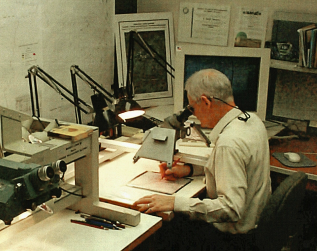
“Ralph has this unique capability, using aerial photography and talking to landowners,” said Mike Penfold of Our Montana. “He really did an amazing job, kind of a forensic study of the corridor.”
For his part, Saunders said it’s interesting how much of the trail still remains visible on steep hills where water has continually run, deepening ruts made 160 years ago.
“As a kid, my granddad pointed out ruts from the Bozeman Trail,” he said. “He had pulled the car over and was pointing up the hill. At that time, it didn’t register much with me.”
Who is Ralph Saunders?
For those unfamiliar with Saunders’ previous work, he may be best known for locating explorer William Clark’s 1806 camp where he stayed with half the Corps of Discovery along the Yellowstone River near Park City.
Saunders has also helped numerous backpackers and hikers with his Rocky Mountain Surveys maps that highlight trails, fish species and stocking dates on maps of the Absaroka-Beartooth Mountains.
Saunders’ Bozeman Trail treatise is just the latest exploration combining his mapping skills with a love of history, because as he noted in this recent book, it is extremely important to him where history happened.
Last year, he received the prestigious Montana Heritage Keeper Award from the Montana Historical Society, recognizing his lifelong contributions to researching and documenting the state’s history.
History of the Bozeman Trail
The Bozeman Trail was pioneered as an emigrant corridor in 1863, a shorter route to reach the gold mines of Virginia City and Bannack. The motivation was that by traveling north, instead of farther west and then north along the existing Oregon Trail, about six weeks of travel could be shaved off the trip.
Although John Bozeman gets credit for the route, portions of it had been in use for thousands of years by wildlife and the Native Americans who followed bison migrations.
“It may be one of the oldest trails in the United States,” Penfold said. “We think that’s interesting.”
Bozeman, an entrepreneur, partnered with mountain man John Jacobs in the endeavor, guiding wagons north from near Casper, Wyoming, along the eastern base of the Bighorn Mountains.
Near present-day Buffalo, Wyoming, the first wagon train in 1863 encountered a party of Sioux and Northern Cheyenne warriors who forced them to turn back. Undeterred by the threat of attack, Bozeman and nine other men completed the route.
The following year, 450 wagons carrying 1,500 people took the route. But the trail would only be heavily used until 1866, despite attempts by the U.S. military to protect the rugged road by constructing forts along the way. Numerous clashes between the settlers, military and Native Americans earned the route the nickname of the “bloody Bozeman.”
Across Montana
In present-day Montana, the Bozeman Trail enters the state south of the rural community of Wyola on the Crow Indian Reservation. From there it passes through Fort Smith, crossing the Bighorn River, and travels on to the communities of Pryor and Edgar.
The 1866 wagon train guided by Bozeman made an ill-fated wrong turn arriving at the Yellowstone River just south of Billings. The ruggedness of the route, which climbed up the South Hills where the Billings Motorcycle Club has named one incline the Bentonite Monster, ensured that path would never be used again.
Once past present-day Billings, the wagon trains encountered numerous creek and river crossings, including the Clarks Fork Yellowstone River, East Rosebud Creek, the Stillwater and Boulder rivers before fording the Yellowstone River near Springdale.
From Joliet to Virginia City, Saunders noted in the book, Bozeman and Jacobs were utilizing a trail mountain man Jim Bridger had pioneered.
Due to its short-lived existence, it’s estimated only 3,500 emigrants used the route.
In Montana alone the trail traversed what are now eight counties. Modern travelers parallel much of the route by driving on Interstate 90 from outside Wyola to Bozeman. At highway speeds, the 300-mile drive would take less than five hours. In comparison, a pioneer would spend roughly two months traveling the route in the 1860s.
Tracking the old trail
To narrow down the actual route, Saunders said “the most important source” was travelers’ diaries. He credited Susan Badger Doyle’s two books, “Bound for Montana, Diaries from the Bozeman Trail” and “Journeys to the Land of Gold, Emigrant Diaries from the Bozeman Trail, 1863-1866.”
Doyle called the corridor “the last great overland emigrant trail in the American West.”
The work took about five years for Saunders to complete, with the route between the Bighorn River and Joliet proving the most challenging, he said. That’s because there were so many “variations and differences of opinion from people who had looked at it before,” Saunders added.
Saunders also relied on his mapmaking skills, utilization of old Government Land Office maps, local sources and ground-truthing explorations with other historians referred to as the Bozeman Trail Team.
Amazingly, he said the devices wagon trains used in the 1800s to measure distances, which were attached to one of the wagon’s wheels, were surprisingly accurate, helping to nail down the location of the trail.
The first half of his book breaks the trail down into different sections, with maps included, detailing how he arrived at the trail’s different locations, which are highlighted in different colors for military, main routes and temporary trails.
The second half of the book provides drivers with a detailed map, photos and driving directions to recreate the route. The notations include advice on where to pull over to see ruts made by the Bozeman Trail wagons.
Favorite section
Saunders dedicated the book to “all those who lost their lives on the Bozeman Trail, including Indians and soldiers, with emphasis on 18-month-old baby Florence French.”
Florence died on July 29, 1864, and was buried somewhere near Butcher Creek in Stillwater County.
This incident, along with his grandfather D. B. Saunders’ early lesson, is partly why the section of the Bozeman Trail near his boyhood home in Stillwater County is what resonates most deeply for Saunders.
“Maybe I’m a little prejudiced,” he said. “But I’m just thankful it’s still as evident in that area as it is.”